Barrea - Lago Vivo (1,591mt)
Trail markers - Park Trail - K4


- Departure: Località Fonte Sambuco (K6) al Km. 67 della SS.83
- Duration: 5 hours (back and forth)
- Difficulty Level: E - Hiking (level)
- Difference in height: 460m
From Barrea town center, head for Alfedena taking SS.83 up to km 67.
When you reach a hairpin bend, on the right, follow a carriage road for about 700m until you reach a detour on the left to the trail marker K4 crossing the beech wood of Valle dell'Inferno and, constantly climbing, you will cross the moraine of an ancient glacier. In 40 minutes you will get to Valico del Buon Passo, with an image of Madonna delle Grazie protecting the travelers. Shortly after, you will get to the highest point of the itinerary (1,656m) and then go down into the wonderful basin where the enchanting Lago Vivo is set at 1,591m, dominated by the summits of Iamiccio, Tartaro, Altare, and Petroso. The latter, with its 2,249m, represents the highest summit of the Park.
With the melting of the snow, the lake reaches in spring its highest levels; the name "vivo" (meaning "alive") derives from the fact that the lake continuously changes its size according to the season. Late in the autumn, its shores are populated by the roe deer during the mating season. On the left edge of the plateau, the so-called "fonte degli uccelli" (spring of the birds) supplies the area with water in any period of the year. The trail continues and gives the opportunity to carry out the journey back across a wonderful beech wood with a beautiful panorama over the lake of Montagna Spaccata.
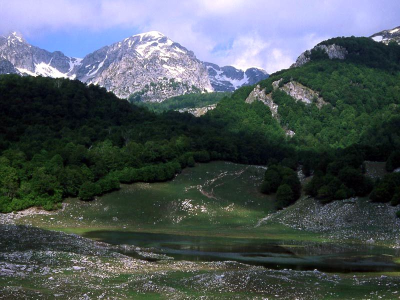
Vivo Lake
(photo by: Romano Visci)