Pianoro delle Forme - Passo dei Monaci (1,967m)
Trail markers - Park Trail - L1


- Departure: Località Pianoro delle Forme - Valle Fiorita - (Pizzone) (1,400m)
- Duration: 5.30 hours (back and forth)
- Difficulty Level: EE - For expert hikers
- Difference in height: 570m
Since 1 January 1990, the areas of Mainarde and Upper Volturno Valley are part of Abruzzo National Park, with their surface area of 4,000 ha and the 5 Municipalities of the Province of Isernia: Pizzone, Castel S. Vincenzo, Rocchetta al Volturno, Scapoli, and Filignano.
ATTENTION! From 28th July to 2nd September 2018 a cap is imposed on the number of people allowed on the trail - info
From Pizzone, a small town whose origins date back to the development of S. Vincenzo al Volturno abbey complex - a feud belonging to the Benedictines until the 14th century - if you follow the SP road you will reach the plateau called "Pianoro delle Forme" or "Valle Fiorita", where you can start climbing to Mt. Meta (2,242m). The access to the summit of Mt. Meta is not allowed to hikers, because it is protected by the Strict Nature Reserve of Abruzzo, Lazio and Molise National Park for the important presence of the Abruzzi Chamois.
Several trails get close to it and reach Passo dei Monaci (1,967m), at the foot of the mountain (about 200 meters from the summit). From loc. Le Forme - Valle Fiorita, where you can park the car, follow the trail with trail marker M1 along Valle Pagana up to Passo dei Monaci. The area is characterized by interesting floristic and vegetation features for the presence of high-mountain valley species; as far as the wildlife is concerned, it is easy to sight the Abruzzi Chamois and, with a bit of luck, the Brown Bear and the Golden Eagle.
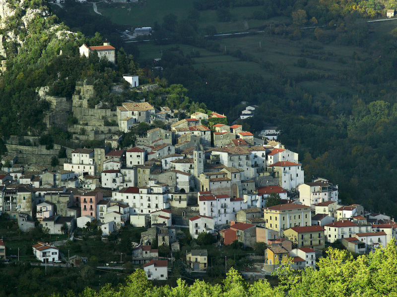
Pizzone
(photo by: Valentino Mastrella, Archivio PNALM)